
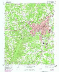
1970 Map of Henderson
USGS Topo · Published 1973About this map
Henderson serves as the focal point of this 1970s landscape, where the convergence of the Southern and Seaboard Coast Line railroads defines the urban layout. The city's growth is evident in the sprawling residential areas of North Henderson and South Henderson, as well as the proximity of Interstate 85, which bypasses the central district. Beyond the urban core, the terrain transitions into a mosaic of small rural communities and family-named landmarks like Dabney and Floytan Crossroads.
Find a feature on this map
59 named features on this map. Tap any name to fly to it.
Don’t see what you’re looking for? This feature index may not catch every label — zoom into the map to look around manually.
Map Details
Editions of this 1970 Henderson Map
2 editions found
Other maps of this area

1943 · Creedmoor
USGS Topo · 1:62,500

1944 · Creedmoor
USGS Topo · 1:62,500

1953 · Oxford
USGS Topo · 1:62,500

1953 · Greensboro
USGS Topo · 1:250,000

1954 · Greensboro
USGS Topo · 1:250,000

1962 · Greensboro
USGS Topo · 1:250,000

1966 · Greensboro
USGS Topo · 1:250,000

1966 · Oxford
USGS Topo · 1:62,500

1970 · Vicksboro
USGS Topo · 1:24,000
1970 · Middleburg
USGS Topo · 1:24,000