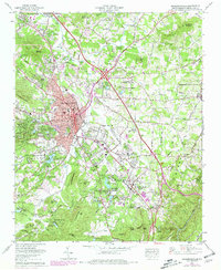
1965 Map of Hendersonville
USGS Topo · Published 1979About this map
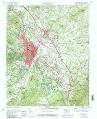
The Southern Railway corridor serves as the industrial and social backbone of this region, connecting the urban core of Hendersonville with outlying mill and mountain communities. During this era of mid-century growth, the landscape is defined by a concentration of seasonal assembly grounds and youth camps, such as the Bonclarken Assembly Grounds and Camp Pinnacle, reflecting the area's established role as a regional retreat. Residential expansion is visible in the purple-shaded growth of Barker Heights and East Flat Rock, while traditional institutions like Oakdale Cem and the Western NC Fairgrounds remain central landmarks. The transition from valley floors to peaks like Stoney Mountain and Glassy Mountain is navigated by historic routes including the Dixie Highway and Howard Gap Road. Local aviation is represented by the Hendersonville-Meyer Airport, situated near the confluence of Mud Creek and Bat Fork.
Find a feature on this map
103 named features on this map. Tap any name to fly to it.
Don’t see what you’re looking for? This feature index may not catch every label — zoom into the map to look around manually.
Map Details
Editions of this 1965 Hendersonville Map
6 editions found
Other maps of this area

1905 · Pisgah
USGS Topo · 1:125,000

1906 · Pisgah
USGS Topo · 1:125,000

1907 · Saluda
USGS Topo · 1:125,000

1935 · Standingstone Mtn.
USGS Topo · 1:24,000

1935 · Horse Shoe
USGS Topo · 1:24,000

1935 · Batcave
USGS Topo · 1:24,000

1935 · Hendersonville
USGS Topo · 1:24,000

1935 · Fishtop
USGS Topo · 1:24,000

1935 · Zirconia
USGS Topo · 1:24,000

1936 · Skyland
USGS Topo · 1:24,000