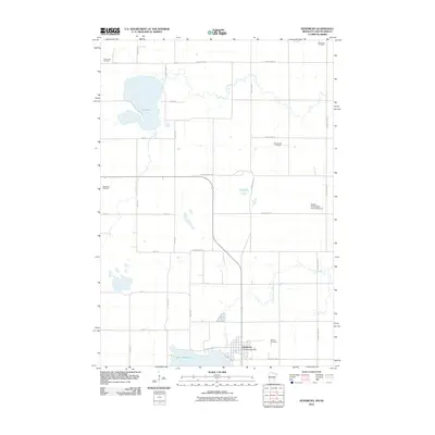
2010 Map of Hendricks
USGS Topo · Published 2010About this map
Hendricks serves as the primary hub of this prairie landscape, situated along the northern shore of Lake Hendricks. The settlement pattern is defined by a rigorous section-line road grid, including County Hwy-17 and County Hwy-132, which connect the town to surrounding agricultural lands. The area is dotted with numerous burial grounds reflecting its early community heritage, such as Wood Lake Cemetery, Bohemian Cemetery, and Hansonville Cemetery.
Find a feature on this map
27 named features on this map. Tap any name to fly to it.
Don’t see what you’re looking for? This feature index may not catch every label — zoom into the map to look around manually.
Map Details
Editions of this 2010 Hendricks Map
This is the sole edition of this map. No revisions or reprints were ever made.
Other maps of this area

1953 · Watertown
USGS Topo · 1:250,000

1958 · Watertown
USGS Topo · 1:250,000

1967 · Canby
USGS Topo · 1:24,000

1967 · Canby NW
USGS Topo · 1:24,000

1967 · Lake Benton NW
USGS Topo · 1:24,000

1967 · Canby SE
USGS Topo · 1:24,000

1967 · Hendricks
USGS Topo · 1:24,000

1967 · Lake Benton NE
USGS Topo · 1:24,000

1970 · Brandt
USGS Topo · 1:24,000

1970 · White NE
USGS Topo · 1:24,000
Featured Places
- Hendricks, MN
- Scandinavia Township, SD
- Lake Hendricks Township, SD
- Brookings County, SD
- Deuel County, SD