
1967 Map of Lake Benton NE
USGS Topo · Published 1969About this map
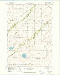
Ivanhoe serves as the focal point of this Lincoln County landscape, situated where the Chicago and North Western railroad crosses the prairie. This late-1960s survey documents a region defined by agricultural drainage and intensive wildlife conservation efforts, evidenced by a dense network of specialized habitats such as the Suhr State Wildlife Management Area and Chain-O-Sloughs State Wildlife Management Area. The natural hydrology of the Yellow Medicine River and its branches is heavily modified by a system of man-made channels, including Judicial Ditch No 22 and County Ditch No 37. Large water bodies like Shaokatan Lake and Ash Lake anchor the southern half of the quadrangle, while several burial grounds, including Shaokatan Cem and the West Elim Cem, provide valuable landmarks for genealogists tracing the area's rural settlement patterns.
Find a feature on this map
36 named features on this map. Tap any name to fly to it.
Don’t see what you’re looking for? This feature index may not catch every label — zoom into the map to look around manually.
Map Details
Editions of this 1967 Lake Benton NE Map
This is the sole edition of this map. No revisions or reprints were ever made.
Other maps of this area

1953 · Watertown
USGS Topo · 1:250,000

1958 · Watertown
USGS Topo · 1:250,000

1963 · Tyler
USGS Topo · 1:24,000

1963 · Arco
USGS Topo · 1:24,000
1967 · Porter SW
USGS Topo · 1:24,000

1967 · Lake Benton NW
USGS Topo · 1:24,000

1967 · Lake Benton
USGS Topo · 1:24,000

1967 · Canby SE
USGS Topo · 1:24,000

1967 · Lake Benton SW
USGS Topo · 1:24,000

1967 · Hendricks
USGS Topo · 1:24,000