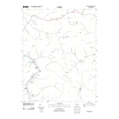
2011 Map of Henlawson
USGS Topo · Published 2011About this map
Mitchell Heights and the surrounding valley communities line the Guyandotte River in this 2011 record of Logan County. The landscape is defined by the tight proximity of residential developments like Guyan Terrace and Justice Addition to the steep, wooded ridges that characterize the region. Historically significant family markers are found throughout the uplands, including Hager Cemetery, Workman Cemetery, and Albright Cemetery, documenting generations of local settlement along the numerous forks and branches.
Find a feature on this map
106 named features on this map. Tap any name to fly to it.
Don’t see what you’re looking for? This feature index may not catch every label — zoom into the map to look around manually.
Map Details
Editions of this 2011 Henlawson Map
This is the sole edition of this map. No revisions or reprints were ever made.
Other maps of this area

1887 · Warfield
USGS Topo · 1:125,000

1891 · Oceana
USGS Topo · 1:125,000

1891 · Warfield
USGS Topo · 1:125,000

1892 · Huntington
USGS Topo · 1:125,000

1893 · Oceana
USGS Topo · 1:125,000

1898 · Huntington
USGS Topo · 1:125,000

1898 · Oceana
USGS Topo · 1:125,000

1899 · Charleston
USGS Topo · 1:125,000
1902 · Midkiff
USGS Topo · 1:62,500
1907 · Midkiff
USGS Topo · 1:62,500