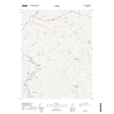
2019 Map of Henlawson
USGS Topo · Published 2019About this map
Mitchell Heights and the surrounding valley communities along the Guyandotte River are defined by a dense network of mountain hollows and residential developments in this 2019 survey. The area shows significant infrastructure for both local transit and family heritage, including the Henlawson Thru Truss Bridge and the Homer D Nelson Bridge crossing the river. Numerous family cemeteries are distributed throughout the terrain, such as Hager Cem and Verner Ball Cem, often situated near the heads of smaller drainages like Garrett Fork or Barker Fork. The map records a landscape of tight-knit settlements like Henlawson, Peach Creek, and Justice Addition that cling to the narrow valley floors. Uplands such as Piney Knob and Godby Knob rise above these inhabited basins, illustrating the classic topography of the Logan County coalfields and the persistent importance of local roads like Trace Fork Rd and Old Logan Rd in connecting these isolated neighborhoods.
Find a feature on this map
123 named features on this map. Tap any name to fly to it.
Don’t see what you’re looking for? This feature index may not catch every label — zoom into the map to look around manually.
Map Details
Editions of this 2019 Henlawson Map
This is the sole edition of this map. No revisions or reprints were ever made.
Other maps of this area

1887 · Warfield
USGS Topo · 1:125,000

1891 · Oceana
USGS Topo · 1:125,000

1891 · Warfield
USGS Topo · 1:125,000

1892 · Huntington
USGS Topo · 1:125,000

1893 · Oceana
USGS Topo · 1:125,000

1898 · Huntington
USGS Topo · 1:125,000

1898 · Oceana
USGS Topo · 1:125,000

1899 · Charleston
USGS Topo · 1:125,000

1902 · Midkiff
USGS Topo · 1:62,500

1907 · Midkiff
USGS Topo · 1:62,500