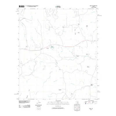
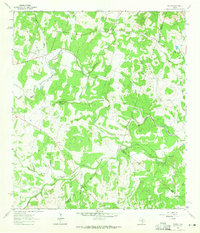
2010 Map of Henly
USGS Topo · Published 2010About this map
Henly sits at the center of this rural landscape in the Texas Hill Country during the early 21st century. The map reveals a high concentration of family cemeteries, such as the Moore Cemetery, Sprouse Cemetery, and Pursley Cemetery, which serve as vital markers for local genealogists tracing long-established ranching families. The terrain is defined by prominent elevations including Mount Gainor and Roundtree Mountain, with numerous waterways like Onion Creek and Barton Creek cutting through the limestone geography. Small-scale aviation facilities like Halm Ranch Airport and Bleakley Ranch Airport indicate the modern ranching lifestyle of the era, while named hollows such as Sprouse Hollow and Rattlesnake Hollow preserve older, traditional place names. This survey captures a balance between traditional family landholdings and the expanding connectivity of Ranch Rd 3232.
Find a feature on this map
35 named features on this map. Tap any name to fly to it.
Don’t see what you’re looking for? This feature index may not catch every label — zoom into the map to look around manually.
Map Details
Editions of this 2010 Henly Map
This is the sole edition of this map. No revisions or reprints were ever made.
Other maps of this area

1887 · Blanco
USGS Topo · 1:125,000

1894 · Blanco
USGS Topo · 1:125,000

1954 · Llano
USGS Topo · 1:250,000

1955 · Llano
USGS Topo · 1:250,000

1956 · Llano
USGS Topo · 1:250,000
1963 · Dripping Springs
USGS Topo · 1:24,000
1963 · Rough Hollow
USGS Topo · 1:24,000

1963 · Yeager Creek
USGS Topo · 1:24,000
1963 · Henly
USGS Topo · 1:24,000
1963 · Payton
USGS Topo · 1:24,000