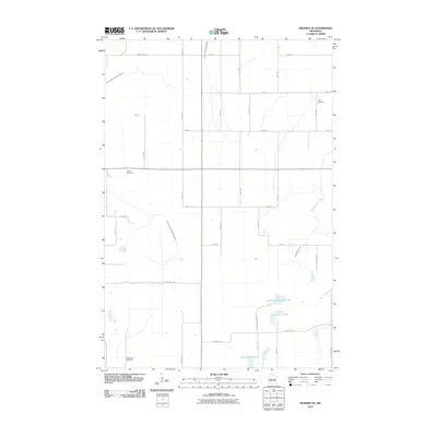
2010 Map of Henning SE
USGS Topo · Published 2010About this map
The agricultural grid of Otter Tail County defines this 2010 survey, where the landscape is etched with an extensive network of drainage infrastructure like County Ditch Number Forty-nine and County Ditch Number Eight. These man-made channels support the high-yield farming of the region, intersecting with natural water features such as South Bluff Creek and the southern marshlands of Wing River Lake. For genealogists, the map identifies three distinct burial sites: Trinity Cemetery in the northeast, Inman Cemetery near the center, and Oak Ridge Cemetery in the southwest. This pattern of small, distributed cemeteries suggests the enduring footprint of early family farmsteads and rural church congregations. Small glacial lakes, including North Lemmerhirt Lake and South Lemmerhirt Lake, punctuate the otherwise uniform section lines established by roads like County Hwy-140 and Elmwood Rd.
Find a feature on this map
23 named features on this map. Tap any name to fly to it.
Don’t see what you’re looking for? This feature index may not catch every label — zoom into the map to look around manually.
Map Details
Editions of this 2010 Henning SE Map
This is the sole edition of this map. No revisions or reprints were ever made.
Other maps of this area

1953 · Brainerd
USGS Topo · 1:250,000

1957 · Brainerd
USGS Topo · 1:250,000

1958 · Brainerd
USGS Topo · 1:250,000

1965 · Brainerd
USGS Topo · 1:250,000

1969 · Henning
USGS Topo · 1:24,000
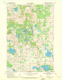
1969 · Parkers Prairie NW
USGS Topo · 1:24,000

1969 · Henning SE
USGS Topo · 1:24,000

1969 · Heinola
USGS Topo · 1:24,000

1969 · Wrightstown
USGS Topo · 1:24,000

1969 · Wadena
USGS Topo · 1:24,000