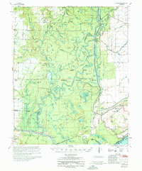
1970 Map of Henrico
USGS Topo · Published 1970About this map
The White River National Wildlife Refuge dominates this delta landscape, where the shifting courses of the White River and Little White River create a labyrinth of oxbows and sloughs. This environment is defined by its complex hydrology, featuring numerous named water bodies like Little Cypress Lake, Horseshoe Lake, and Tupelo Lake. The map details the human infrastructure required to navigate and manage this riverine world, from the Graham Burke Pumping Station to Lock and Dam No 1.
Find a feature on this map
120 named features on this map. Tap any name to fly to it.
Don’t see what you’re looking for? This feature index may not catch every label — zoom into the map to look around manually.
Map Details
Editions of this 1970 Henrico Map
This is the sole edition of this map. No revisions or reprints were ever made.
Other maps of this area

1930 · Mellwood
USGS Topo · 1:62,500

1935 · Red Fork
USGS Topo · 1:62,500

1935 · Gillett
USGS Topo · 1:62,500

1939 · Modoc
USGS Topo · 1:62,500

1939 · Indian Bay
USGS Topo · 1:62,500

1939 · Henrico
USGS Topo · 1:62,500

1939 · Pace
USGS Topo · 1:62,500

1939 · Big Island
USGS Topo · 1:62,500

1939 · Mellwood
USGS Topo · 1:62,500

1941 · De Witt
USGS Topo · 1:62,500