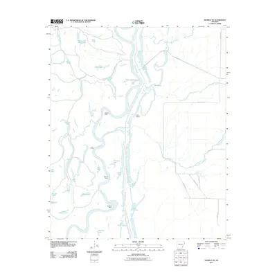
2011 Map of Henrico NE
USGS Topo · Published 2011About this map
The White River carves a winding path through this corner of Phillips County, defining a complex system of oxbow lakes, bayous, and sediment points. The landscape is dominated by the alluvial dynamics of the river, which has left behind numerous water bodies including Lower White Lake, Escronges Lake, and the connected Mud Lakes. These features represent the shifting hydrology of the Delta region, where the land and water are constantly reshaped by seasonal flows.
Find a feature on this map
43 named features on this map. Tap any name to fly to it.
Don’t see what you’re looking for? This feature index may not catch every label — zoom into the map to look around manually.
Map Details
Editions of this 2011 Henrico NE Map
This is the sole edition of this map. No revisions or reprints were ever made.
Other maps of this area

1930 · Mellwood
USGS Topo · 1:62,500

1939 · Modoc
USGS Topo · 1:62,500

1939 · Indian Bay
USGS Topo · 1:62,500

1939 · Henrico
USGS Topo · 1:62,500

1939 · Mellwood
USGS Topo · 1:62,500

1948 · Helena
USGS Topo · 1:250,000

1948 · Modoc
USGS Topo · 1:62,500

1950 · Helena
USGS Topo · 1:250,000

1954 · Mellwood
USGS Topo · 1:62,500

1954 · Indian Bay
USGS Topo · 1:62,500