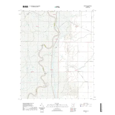
2020 Map of Henrico NE
USGS Topo · Published 2020About this map
The boundary between Arkansas County and Phillips County follows the shifting, serpentine path of the White River in this delta survey. The landscape is defined by its complex hydrography, characterized by numerous oxbow lakes and sloughs that indicate the river's historical movement. Features like Horseshoe Lake, Star Lake, and Bear Lake sit alongside backwater bayous such as Essex Bayou and Bradley Bayou. The presence of the Champion Cypress Trail and numerous named points like Jackass Point and Mussell Point suggest a terrain navigated primarily by water and specialized trails. Girard Ranch stands as a primary named settlement marker in an area dominated by wetlands and periodic flooding zones, while Little Island and Little Bee Bayou illustrate the fragmented nature of the land between the watercourses.
Find a feature on this map
50 named features on this map. Tap any name to fly to it.
Don’t see what you’re looking for? This feature index may not catch every label — zoom into the map to look around manually.
Map Details
Editions of this 2020 Henrico NE Map
This is the sole edition of this map. No revisions or reprints were ever made.
Other maps of this area

1930 · Mellwood
USGS Topo · 1:62,500

1939 · Modoc
USGS Topo · 1:62,500

1939 · Indian Bay
USGS Topo · 1:62,500

1939 · Henrico
USGS Topo · 1:62,500

1939 · Mellwood
USGS Topo · 1:62,500

1948 · Helena
USGS Topo · 1:250,000

1948 · Modoc
USGS Topo · 1:62,500

1950 · Helena
USGS Topo · 1:250,000

1954 · Mellwood
USGS Topo · 1:62,500

1954 · Indian Bay
USGS Topo · 1:62,500