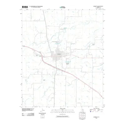
2010 Map of Henrietta
USGS Topo · Published 2010About this map
Henrietta serves as the central hub of this North Texas landscape, where the confluence of regional travel and water management is clearly visible. The town's grid is bounded by the Little Wichita River and its various branches, including the Dry Fork Little Wichita River. Critical local infrastructure like the Henrietta City Reservoir 1 and Henrietta Reservoir 2 north of the town center illustrate the necessity of water storage in Clay County.
Find a feature on this map
42 named features on this map. Tap any name to fly to it.
Don’t see what you’re looking for? This feature index may not catch every label — zoom into the map to look around manually.
Map Details
Editions of this 2010 Henrietta Map
This is the sole edition of this map. No revisions or reprints were ever made.
Other maps of this area

1954 · Wichita Falls
USGS Topo · 1:250,000

1956 · Henrietta
USGS Topo · 1:62,500

1957 · Wichita Falls East
USGS Topo · 1:62,500

1958 · Wichita Falls
USGS Topo · 1:250,000

1963 · Deer Creek
USGS Topo · 1:24,000
1968 · Bellevue
USGS Topo · 1:24,000
1968 · Bluegrove
USGS Topo · 1:24,000
1972 · Dean
USGS Topo · 1:24,000
1972 · Jolly
USGS Topo · 1:24,000
1984 · Henrietta
USGS Topo · 1:24,000