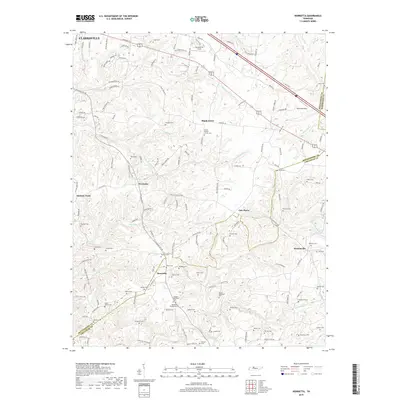
2019 Map of Henrietta
USGS Topo · Published 2019About this map
The rolling landscape south of Clarksville is defined by a dense network of family-named cemeteries and rural crossroads settlements. Small communities such as Shady Grove, Fredonia, and Henrietta anchor the map, connected by historic routes like Old Clarksville Pike and Ashland City Rd. The topography is carved by a system of creeks and springs, including Big McAdoo Creek and the headwaters of Half Pone Creek, which draw the lines of the watershed toward the Cheatham County line. For the genealogist, this survey is particularly valuable for its precise locations of family burial grounds, including the Hollis-Nanny Cemetery and multiple distinct sites associated with the Nicholson family, such as the Permelia Nicholson Cemetery and Hobson-Nicholson Cemetery. These landmarks provide a clear record of family landholdings and settlement patterns in the rural corridor between Thomasville and Oak Plains.
Find a feature on this map
142 named features on this map. Tap any name to fly to it.
Don’t see what you’re looking for? This feature index may not catch every label — zoom into the map to look around manually.
Map Details
Editions of this 2019 Henrietta Map
This is the sole edition of this map. No revisions or reprints were ever made.
Other maps of this area

1944 · Clarksville
USGS Topo · 1:50,000

1951 · Clarksville
USGS Topo · 1:24,000

1956 · Nashville
USGS Topo · 1:250,000

1957 · Cheatham Dam
USGS Topo · 1:24,000

1957 · Adams
USGS Topo · 1:24,000

1957 · Pleasant View
USGS Topo · 1:24,000

1957 · Henrietta
USGS Topo · 1:24,000

1957 · Ashland City
USGS Topo · 1:24,000

1957 · Sango
USGS Topo · 1:24,000

1957 · Clarksville
USGS Topo · 1:24,000