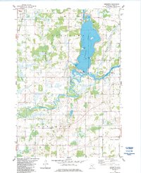
1983 Map of Henriette
USGS Topo · Published 1984About this map
Pokegama Lake dominates the upper half of this landscape, its western shoreline defined by Jarvis Bay and its waters broken by Tuxedo Bar and Clappe Bar. The aquatic environment is complex, featuring the meandering Snake River that feeds into several wetlands and the State Wildlife Management Area. Cultural and historic landmarks are concentrated along the river and rail lines, most notably the Fur Post Historic Site located where the river bends toward the southeast.
Find a feature on this map
21 named features on this map. Tap any name to fly to it.
Don’t see what you’re looking for? This feature index may not catch every label — zoom into the map to look around manually.
Map Details
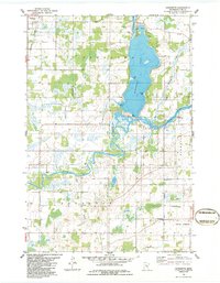
Editions of this 1983 Henriette Map
2 editions found
Other maps of this area

1950 · Rush City
USGS Topo · 1:48,000

1953 · Stillwater
USGS Topo · 1:250,000

1955 · Rush City
USGS Topo · 1:62,500

1955 · Stillwater
USGS Topo · 1:250,000

1958 · Stillwater
USGS Topo · 1:250,000

1961 · Cambridge
USGS Topo · 1:62,500

1961 · Brook Park
USGS Topo · 1:62,500

1961 · Pine City
USGS Topo · 1:62,500

1965 · Stillwater
USGS Topo · 1:250,000

1975 · Stillwater
USGS Topo · 1:250,000