
2016 Map of Henryetta SW
USGS Topo · Published 2016About this map
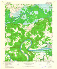
The North Canadian River meanders through this section of eastern Oklahoma, forming a complex landscape of oxbows and floodplains at the intersection of McIntosh, Okfuskee, and Hughes counties. In the northeastern corner, the Red Hill settlement sits near the Red Hill Cem, a site of significant interest for genealogists and local historians tracing family roots in the region. The terrain is defined by dramatic depressions like Rattlesnake Hollow and Spring Hollow, while the Indian Nation Tpke bisects the area, providing a modern transport artery across the historical watershed of Wolf Cr and Bob Cr. The local road network, including names such as John Artussee Rd, reflects the enduring cultural and geographic markers of this rural Oklahoma landscape.
Find a feature on this map
32 named features on this map. Tap any name to fly to it.
Don’t see what you’re looking for? This feature index may not catch every label — zoom into the map to look around manually.
Map Details
Editions of this 2016 Henryetta SW Map
This is the sole edition of this map. No revisions or reprints were ever made.
Other maps of this area
1900 · Canadian
USGS Topo · 1:125,000
1900 · Wewoka
USGS Topo · 1:125,000
1946 · Fort Smith
USGS Topo · 1:250,000
1954 · Oklahoma City
USGS Topo · 1:250,000
1957 · Oklahoma City
USGS Topo · 1:250,000
1962 · Henryetta
USGS Topo · 1:24,000
1962 · Raiford
USGS Topo · 1:24,000
1962 · Henryetta SW
USGS Topo · 1:24,000
1962 · Hoffman
USGS Topo · 1:24,000
1963 · Oklahoma City
USGS Topo · 1:250,000