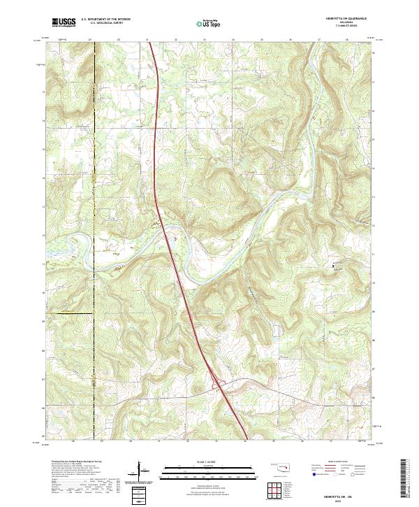
2022 Map of Henryetta SW
USGS Topo · Published 2022About this map
The North Canadian River winds through this landscape, creating a complex network of wetlands and tributaries where Mcintosh Co, Okfuskee Co, and Hughes Co converge. The topography is defined by significant drainage features such as Rattlesnake Hollow and Spring Hollow, which feed into the primary river valley. High ground is marked by Red Hill, where the local Red Hill Cem provides a point of genealogical interest for those researching families from this rural tri-county border area. A grid of section roads, including John Artussee Rd, provides access to the creek bottoms of Wolf Cr and Fish Cr, showing a settlement pattern deeply tied to the natural hydrology of the basin. The 2022 survey data illustrates the enduring rural character of this region, where land use remains primarily defined by the river's path and the surrounding wooded hollows.
Find a feature on this map
36 named features on this map. Tap any name to fly to it.
Don’t see what you’re looking for? This feature index may not catch every label — zoom into the map to look around manually.
Map Details
Editions of this 2022 Henryetta SW Map
This is the sole edition of this map. No revisions or reprints were ever made.
Other maps of this area

1900 · Canadian
USGS Topo · 1:125,000

1900 · Wewoka
USGS Topo · 1:125,000

1946 · Fort Smith
USGS Topo · 1:250,000

1954 · Oklahoma City
USGS Topo · 1:250,000

1957 · Oklahoma City
USGS Topo · 1:250,000

1962 · Henryetta
USGS Topo · 1:24,000

1962 · Raiford
USGS Topo · 1:24,000

1962 · Henryetta SW
USGS Topo · 1:24,000

1962 · Hoffman
USGS Topo · 1:24,000

1963 · Oklahoma City
USGS Topo · 1:250,000