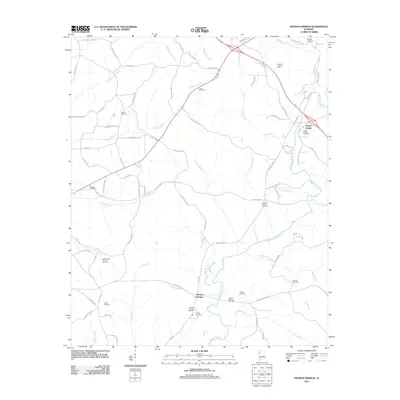
2011 Map of Henson Springs
USGS Topo · Published 2011About this map
The Buttahatchee River meanders through this portion of Marion County, anchoring a landscape defined by small river-bend settlements and deep-rooted family landmarks. In the settlement of Henson Springs, the presence of the Henson Springs Oil Field and the nearby East Detroit Oil and Gas Field indicates the importance of local energy extraction to the rural economy during this period. The terrain is marked by numerous family burial grounds, including the Cantrell Family Cemetery and Crump Cemetery, which provide significant anchor points for genealogists tracing regional lineages.
Find a feature on this map
89 named features on this map. Tap any name to fly to it.
Don’t see what you’re looking for? This feature index may not catch every label — zoom into the map to look around manually.
Map Details
Editions of this 2011 Henson Springs Map
This is the sole edition of this map. No revisions or reprints were ever made.
Other maps of this area

1953 · Birmingham
USGS Topo · 1:250,000

1953 · West Point
USGS Topo · 1:250,000

1956 · Birmingham
USGS Topo · 1:250,000

1956 · Gadsden
USGS Topo · 1:250,000

1956 · Tupelo
USGS Topo · 1:250,000

1957 · Birmingham
USGS Topo · 1:250,000

1958 · Tupelo
USGS Topo · 1:250,000

1958 · West Point
USGS Topo · 1:250,000

1958 · Gadsden
USGS Topo · 1:250,000

1960 · Gadsden
USGS Topo · 1:250,000