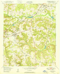
1950 Map of Hephzibah
USGS Topo · Published 1950About this map
Industrial and rural landscapes intersect at the Albion Kaolin Chalk Mine in Richmond County, where kaolin extraction shaped the local economy and community life mid-century. The settlement of Hephzibah serves as a central hub, connected to the wider region by the Georgia and Florida RR and the notable thoroughfare of Tobacco Road. The terrain is defined by the drainage systems of Spirit Creek and its many tributaries, including Little Spirit Creek and Johnsons Branch, which feed into local landmarks like the Richmond Factory Pond and Hancock Millpond.
Find a feature on this map
44 named features on this map. Tap any name to fly to it.
Don’t see what you’re looking for? This feature index may not catch every label — zoom into the map to look around manually.
Map Details
Editions of this 1950 Hephzibah Map
This is the sole edition of this map. No revisions or reprints were ever made.
Other maps of this area

1919 · Gough
USGS Topo · 1:62,500

1920 · Greens Cut
USGS Topo · 1:62,500

1921 · Augusta
USGS Topo · 1:62,500

1922 · Hephzibah
USGS Topo · 1:62,500

1943 · Greens Cut
USGS Topo · 1:62,500

1943 · Augusta East
USGS Topo · 1:125,000

1943 · Augusta
USGS Topo · 1:62,500

1948 · Hephzibah
USGS Topo · 1:62,500

1948 · Gough
USGS Topo · 1:62,500

1948 · Blythe
USGS Topo · 1:24,000