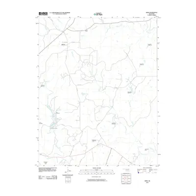
2010 Map of Herd
USGS Topo · Published 2010About this map
Mission Creek and Buck Creek converge in this northern Osage County landscape, where the small settlement of Herd sits along the roadway. The area is defined by a complex network of drainage systems and man-made water management, including numerous small reservoirs such as Deer Lake and Sunset Lake. The topography is punctuated by distinctive landmarks like Twin Mounds in the west and the winding Horseshoe Bend of Rock Creek in the southeast.
Find a feature on this map
34 named features on this map. Tap any name to fly to it.
Don’t see what you’re looking for? This feature index may not catch every label — zoom into the map to look around manually.
Map Details
Editions of this 2010 Herd Map
This is the sole edition of this map. No revisions or reprints were ever made.
Other maps of this area

1906 · Nelagoney
USGS Topo · 1:24,000

1909 · Pawhuska
USGS Topo · 1:125,000

1910 · Pawhuska
USGS Topo · 1:125,000

1955 · Enid
USGS Topo · 1:250,000

1958 · Enid
USGS Topo · 1:250,000

1960 · Nanos
USGS Topo · 1:24,000

1960 · Nelagoney
USGS Topo · 1:24,000

1960 · Herd
USGS Topo · 1:24,000

1960 · Pawhuska
USGS Topo · 1:24,000
1971 · Bowring
USGS Topo · 1:24,000