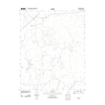
2012 Map of Herd
USGS Topo · Published 2012About this map
Herd and Bigheart stand as the primary geographic markers in this northern Oklahoma landscape, where the prairie is dissected by a dense network of watercourses and county roads. The terrain is defined by the winding paths of Mission Cr, Buck Cr, and Rock Cr, which drain toward notable features like Lookout Lake and Deer Lake. In the northeast corner, the Moore Cem provides a specific point of interest for genealogists tracing family histories in Osage County. Distinctive landforms such as Twin Mounds and Horseshoe Bend on Buck Cr suggest a landscape where natural topography remains the dominant feature, even as a grid of numbered county roads like Co RD-3455 and n3910 RD provides access to remote parcels and homesteads across the territory.
Find a feature on this map
37 named features on this map. Tap any name to fly to it.
Don’t see what you’re looking for? This feature index may not catch every label — zoom into the map to look around manually.
Map Details
Editions of this 2012 Herd Map
This is the sole edition of this map. No revisions or reprints were ever made.
Other maps of this area

1906 · Nelagoney
USGS Topo · 1:24,000

1909 · Pawhuska
USGS Topo · 1:125,000

1910 · Pawhuska
USGS Topo · 1:125,000

1955 · Enid
USGS Topo · 1:250,000

1958 · Enid
USGS Topo · 1:250,000

1960 · Nanos
USGS Topo · 1:24,000

1960 · Nelagoney
USGS Topo · 1:24,000

1960 · Herd
USGS Topo · 1:24,000

1960 · Pawhuska
USGS Topo · 1:24,000
1971 · Bowring
USGS Topo · 1:24,000