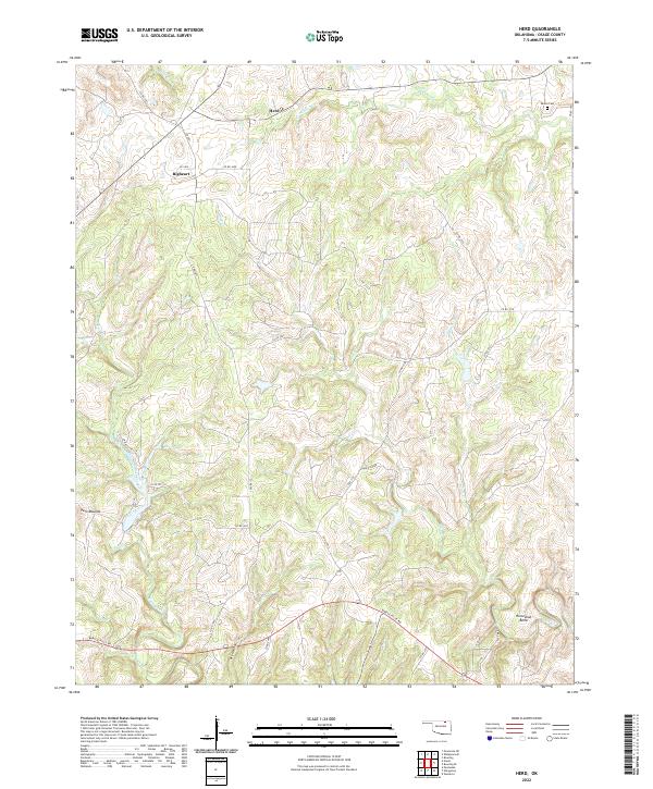
2022 Map of Herd
USGS Topo · Published 2022About this map
The community of Herd and the nearby settlement of Bigheart occupy the rolling hills of Osage County in this modern topographic study. The landscape is defined by the winding drainages of Buck Cr and Mission Cr in the north, while Rock Creek and Ranch Creek cut through the southern terrain. This area remains largely rural, dominated by vast ranching lands and intricate creek systems that feed into Deer Lake.
Find a feature on this map
40 named features on this map. Tap any name to fly to it.
Don’t see what you’re looking for? This feature index may not catch every label — zoom into the map to look around manually.
Map Details
Editions of this 2022 Herd Map
This is the sole edition of this map. No revisions or reprints were ever made.
Other maps of this area

1906 · Nelagoney
USGS Topo · 1:24,000

1909 · Pawhuska
USGS Topo · 1:125,000

1910 · Pawhuska
USGS Topo · 1:125,000

1955 · Enid
USGS Topo · 1:250,000

1958 · Enid
USGS Topo · 1:250,000

1960 · Nanos
USGS Topo · 1:24,000

1960 · Nelagoney
USGS Topo · 1:24,000

1960 · Herd
USGS Topo · 1:24,000

1960 · Pawhuska
USGS Topo · 1:24,000
1971 · Bowring
USGS Topo · 1:24,000