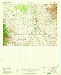
1952 Map of Hereford
USGS Topo · Published 1959About this map
The San Rafael Valley floor and the rising slopes of the Coronado National Forest define this 1950s borderland landscape. The San Pedro River flows northward toward Hereford, a key settlement where the Southern Pacific railroad meets a dense network of family-owned ranching operations. Traces of the region's agricultural and mining economy are evident at the Double Mill Pumps and the Baumkirchner Mine, while an Airfield (Abandoned) south of Hereford marks a change in local aviation use. The map illustrates a high concentration of established homesteads, such as the Smiling Tiger Ranch and Kinjoekity Ranch, scattered across the basin. Along the southern boundary, the United States Mexico international border runs just below the Coronado National Memorial, capturing the junction of Arizona Sonora in the mid-century era.
Find a feature on this map
54 named features on this map. Tap any name to fly to it.
Don’t see what you’re looking for? This feature index may not catch every label — zoom into the map to look around manually.
Map Details
Editions of this 1952 Hereford Map
2 editions found
Other maps of this area

1902 · Bisbee
USGS Topo · 1:62,500

1910 · Bisbee
USGS Topo · 1:62,500

1914 · Hereford
USGS Topo · 1:125,000

1915 · Benson
USGS Topo · 1:125,000

1916 · Pearce
USGS Topo · 1:125,000

1916 · Douglas
USGS Topo · 1:125,000

1919 · Douglas
USGS Topo · 1:125,000

1922 · Sunnyside
USGS Topo · 1:62,500

1925 · Gleeson
USGS Topo · 1:62,500

1927 · Bisbee
USGS Topo · 1:62,500