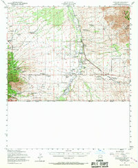
1952 Map of Hereford
USGS Topo · Published 1967About this map
The San Pedro River corridor serves as the primary axis for this 1950s-era landscape along the international border between the United States and Mexico. The settlement pattern is defined by a dense network of named cattle operations, ranging from the Kinjoockity Ranch and Smiling Tiger Ranch to the Y-Lightning Ranch, reflecting the region's deep ranching heritage. The Southern Pacific railroad line cuts diagonally across the basin, supporting small hubs like Hereford and Palominas, while an Abandoned Airfield and a small Nicksville airport suggest the evolving aerial accessibility of the borderlands.
Find a feature on this map
62 named features on this map. Tap any name to fly to it.
Don’t see what you’re looking for? This feature index may not catch every label — zoom into the map to look around manually.
Map Details
Editions of this 1952 Hereford Map
2 editions found
Other maps of this area

1902 · Bisbee
USGS Topo · 1:62,500

1910 · Bisbee
USGS Topo · 1:62,500

1914 · Hereford
USGS Topo · 1:125,000

1915 · Benson
USGS Topo · 1:125,000

1916 · Pearce
USGS Topo · 1:125,000

1916 · Douglas
USGS Topo · 1:125,000

1919 · Douglas
USGS Topo · 1:125,000

1922 · Sunnyside
USGS Topo · 1:62,500

1925 · Gleeson
USGS Topo · 1:62,500

1927 · Bisbee
USGS Topo · 1:62,500