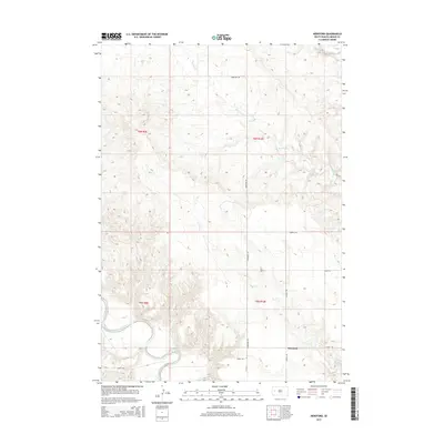
2015 Map of Hereford
USGS Topo · Published 2015About this map
Hereford sits within a landscape defined by the winding course of the Belle Fourche River as it cuts through Meade County. This 2015 U.S. Geological Survey representation captures the rural character of the region, where a network of gravel and local roads like Hereford Rd and Alkali Rd connect isolated homesteads and ranching lands. The topography is deeply etched by a system of intermittent waterways, including Elm Cr, Dry Elm Cr, and Dry Cr, which flow toward the primary river valley. The map details the Township and Range system across boundaries such as t6n r9e and t5n r10e, illustrating the geometric land divisions typical of the Great Plains. Local access points like Wurnig Rd and Landfall Pl provide specific navigation markers for genealogists and local historians tracing family holdings near the river's edge.
Find a feature on this map
16 named features on this map. Tap any name to fly to it.
Don’t see what you’re looking for? This feature index may not catch every label — zoom into the map to look around manually.
Map Details
Editions of this 2015 Hereford Map
This is the sole edition of this map. No revisions or reprints were ever made.
Other maps of this area

1893 · Rapid
USGS Topo · 1:125,000

1898 · Rapid
USGS Topo · 1:125,000

1903 · Rapid
USGS Topo · 1:125,000

1913 · Newell
USGS Topo · 1:125,000

1951 · Volunteer SE
USGS Topo · 1:24,000

1953 · Hereford SE
USGS Topo · 1:24,000

1953 · Hereford
USGS Topo · 1:24,000

1953 · Hereford SW
USGS Topo · 1:24,000

1953 · Rapid City 1 NE
USGS Topo · 1:24,000

1953 · Rapid City 1 SE
USGS Topo · 1:24,000