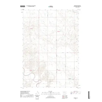
2017 Map of Hereford
USGS Topo · Published 2017About this map
The Belle Fourche River winds through the southern reaches of this Meade County landscape, defining the local topography and drainage patterns. The small settlement of Hereford sits at the intersection of Alkali Rd and Wuring Rd, serving as a central point for the surrounding ranching and agricultural lands. North of the river, a series of seasonal drainages including Dry Cr, Dry Elm Cr, and Elm Cr carve deep channels into the prairie, illustrating the erosional forces that shape this portion of South Dakota. Genealogical and historical interest is anchored by the Saint Eustace Cem, located along Hereford Rd. The map detail captures the modern road network, such as Cross S Rd and Landfall Pl, overlaid on the traditional Public Land Survey System grids of t6n r10e and t5n r10e.
Find a feature on this map
17 named features on this map. Tap any name to fly to it.
Don’t see what you’re looking for? This feature index may not catch every label — zoom into the map to look around manually.
Map Details
Editions of this 2017 Hereford Map
This is the sole edition of this map. No revisions or reprints were ever made.
Other maps of this area

1893 · Rapid
USGS Topo · 1:125,000

1898 · Rapid
USGS Topo · 1:125,000

1903 · Rapid
USGS Topo · 1:125,000

1913 · Newell
USGS Topo · 1:125,000

1951 · Volunteer SE
USGS Topo · 1:24,000

1953 · Hereford SE
USGS Topo · 1:24,000

1953 · Hereford
USGS Topo · 1:24,000

1953 · Hereford SW
USGS Topo · 1:24,000

1953 · Rapid City 1 NE
USGS Topo · 1:24,000

1953 · Rapid City 1 SE
USGS Topo · 1:24,000