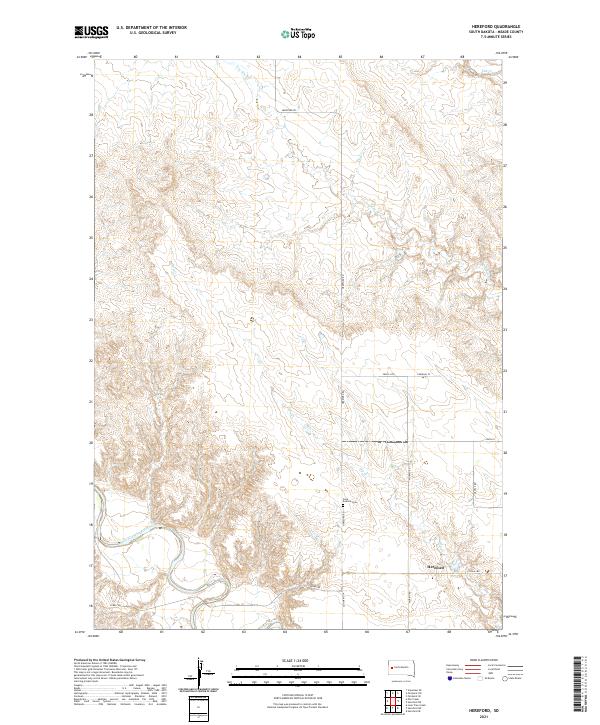
2021 Map of Hereford
USGS Topo · Published 2021About this map
The Hereford settlement sits at the heart of this Meade County landscape, where the meandering Belle Fourche River snakes through the southwestern corner. The terrain is defined by a series of north-to-south drainages, most notably Dry Elm Cr and Elm Cr, which carve through the high plains. This map illustrates a rural ranching and farming community structured around a grid of gravel and local roads like Hereford Rd and Alkali Rd. Genealogists and local historians will find the Saint Eustace Cem located north of the river, providing a specific point of reference for the families who settled this portion of South Dakota. The juxtaposition of the permanent river flow against the intermittent creek beds highlights the water-dependent nature of settlement in this arid region.
Find a feature on this map
16 named features on this map. Tap any name to fly to it.
Don’t see what you’re looking for? This feature index may not catch every label — zoom into the map to look around manually.
Map Details
Editions of this 2021 Hereford Map
This is the sole edition of this map. No revisions or reprints were ever made.
Other maps of this area

1893 · Rapid
USGS Topo · 1:125,000

1898 · Rapid
USGS Topo · 1:125,000

1903 · Rapid
USGS Topo · 1:125,000

1913 · Newell
USGS Topo · 1:125,000

1951 · Volunteer SE
USGS Topo · 1:24,000

1953 · Hereford SE
USGS Topo · 1:24,000

1953 · Hereford
USGS Topo · 1:24,000

1953 · Hereford SW
USGS Topo · 1:24,000

1953 · Rapid City 1 NE
USGS Topo · 1:24,000

1953 · Rapid City 1 SE
USGS Topo · 1:24,000