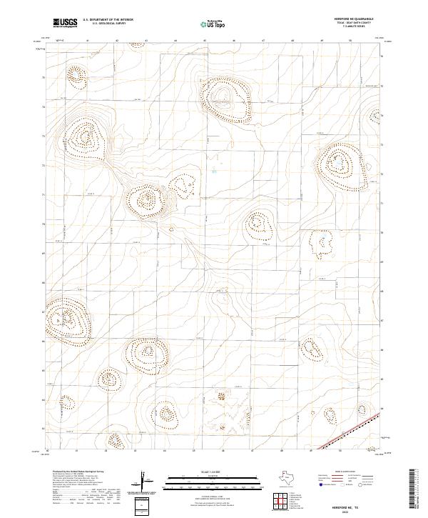
2022 Map of Hereford NE
USGS Topo · Published 2022About this map
Agricultural grid lines and natural playa depressions define this High Plains landscape northeast of Hereford. The terrain is organized by an extensive network of rural routes, including Fm 1062 and N Progressive Rd, which divide the land into large rectangular sections typical of Texas Panhandle ranching and farming operations. The map reveals the subtle topography of the Llano Estacado, where the regular intervals of roads like Co Rd 14 and Co Rd EE are occasionally interrupted by the rounded contours of shallow basins. These geographic features often collect seasonal water, serving as critical points for local wildlife and livestock in an otherwise dry expanse. The transition from state-maintained roads like Ranch Rd 1062 to more localized county connectors illustrates the transportation infrastructure required to support the region's isolated homesteads and industrial-scale agriculture.
Find a feature on this map
20 named features on this map. Tap any name to fly to it.
Don’t see what you’re looking for? This feature index may not catch every label — zoom into the map to look around manually.
Map Details
Editions of this 2022 Hereford NE Map
This is the sole edition of this map. No revisions or reprints were ever made.
Other maps of this area

1954 · Tucumcari
USGS Topo · 1:250,000

1954 · Clovis
USGS Topo · 1:250,000

1958 · Clovis
USGS Topo · 1:250,000

1958 · Tucumcari
USGS Topo · 1:250,000

1961 · Buffalo Lake
USGS Topo · 1:62,500

1962 · Wildorado
USGS Topo · 1:62,500

1965 · Allison Ranch
USGS Topo · 1:24,000

1966 · Ford
USGS Topo · 1:24,000

1970 · Hereford
USGS Topo · 1:24,000

1971 · Hereford NE
USGS Topo · 1:24,000