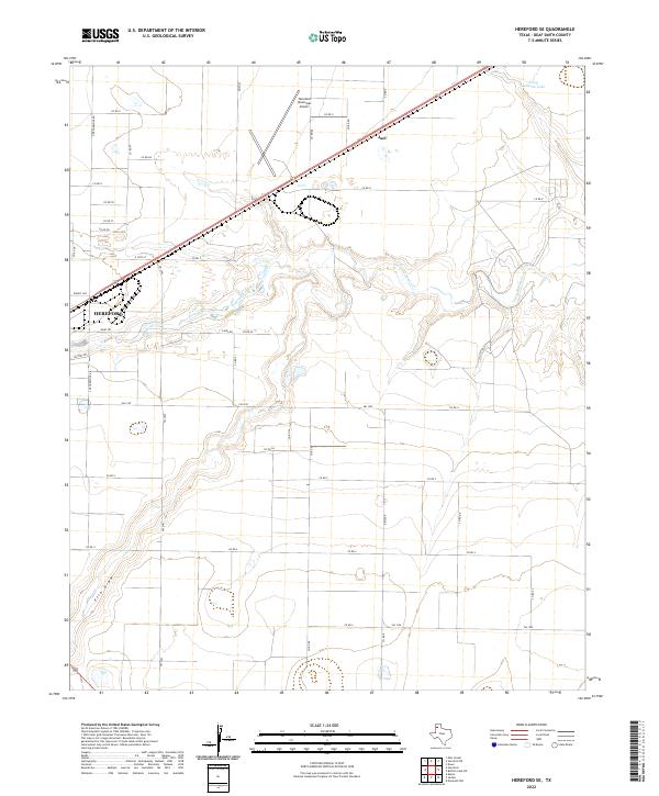
2022 Map of Hereford SE
USGS Topo · Published 2022About this map
Hereford sits at the western edge of this High Plains landscape, where the town's grid meets an extensive network of rural county roads. The terrain is defined by the winding course of Tierra Blanca Cr, which snakes through the center of the quadrangle toward Leroy Johnson Lake in the northeast. To the south, the wide depression of Frio Draw cuts across the panhandle soil, illustrating the natural drainage patterns that have shaped local ranching and agriculture. The intersection of transportation and commerce is evident in the northeast, where the Joel siding and the Hereford Municipal Airport serve the region's logistical needs. A dense grid of numbered routes, including Co RD 9 and FM 2943, connects remote farmsteads to the urban center at Victory Dr and Dairy Rd.
Find a feature on this map
35 named features on this map. Tap any name to fly to it.
Don’t see what you’re looking for? This feature index may not catch every label — zoom into the map to look around manually.
Map Details
Editions of this 2022 Hereford SE Map
This is the sole edition of this map. No revisions or reprints were ever made.
Other maps of this area

1954 · Clovis
USGS Topo · 1:250,000

1958 · Clovis
USGS Topo · 1:250,000

1961 · Buffalo Lake
USGS Topo · 1:62,500

1966 · Jumbo
USGS Topo · 1:24,000

1966 · Nazareth NW
USGS Topo · 1:24,000

1966 · Easter
USGS Topo · 1:24,000

1970 · Hereford
USGS Topo · 1:24,000

1971 · Hereford NE
USGS Topo · 1:24,000
1971 · Milo Center
USGS Topo · 1:24,000

1971 · Hereford SE
USGS Topo · 1:24,000