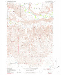
1953 Map of Hereford SW
USGS Topo · Published 1981About this map
The Belle Fourche River meanders across the northern reaches of this territory in Meade County, creating a sharp contrast against the surrounding dissected plains. This mid-century landscape is defined by its drainage patterns, where Alkali Creek and Boydson Draw carve through the terrain, leading toward the river valley. The map reveals the infrastructure of a rural ranching economy, punctuated by isolated but vital landmarks such as the Brechtel Sch and a namesake Spring in the southern sections.
Find a feature on this map
7 named features on this map. Tap any name to fly to it.
Don’t see what you’re looking for? This feature index may not catch every label — zoom into the map to look around manually.
Map Details
Editions of this 1953 Hereford SW Map
2 editions found
Other maps of this area

1893 · Rapid
USGS Topo · 1:125,000

1898 · Rapid
USGS Topo · 1:125,000

1903 · Rapid
USGS Topo · 1:125,000

1953 · Bend
USGS Topo · 1:24,000

1953 · Viewfield
USGS Topo · 1:24,000

1953 · Hereford SE
USGS Topo · 1:24,000

1953 · Hereford
USGS Topo · 1:24,000

1953 · Hereford SW
USGS Topo · 1:24,000

1953 · Rapid City 1 NE
USGS Topo · 1:24,000

1953 · Rapid City 1 SE
USGS Topo · 1:24,000