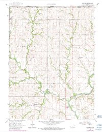
1966 Map of Herkimer
USGS Topo · Published 1983About this map
The Old Indian Treaty Boundary cuts across this prairie landscape, serving as a reminder of the shifting administrative and tribal borders of north-central Kansas. Centered around the small settlement of Herkimer, the map reveals a rural community supported by a dense network of country schools and churches, including Bethlehem Sch, Sunrise Sch, and Deer Creek Sch. The industrial presence is concentrated along the Union Pacific rail line and the banks of the Big Blue River, where a Sandpit and Quarry indicate the local extraction of natural resources.
Find a feature on this map
33 named features on this map. Tap any name to fly to it.
Don’t see what you’re looking for? This feature index may not catch every label — zoom into the map to look around manually.
Map Details
Editions of this 1966 Herkimer Map
2 editions found
Other maps of this area

1889 · Marysville
USGS Topo · 1:125,000

1894 · Marysville
USGS Topo · 1:125,000

1955 · Manhattan
USGS Topo · 1:250,000

1955 · Lincoln
USGS Topo · 1:250,000

1956 · Manhattan
USGS Topo · 1:250,000

1957 · Manhattan
USGS Topo · 1:250,000

1957 · Lincoln
USGS Topo · 1:250,000

1958 · Lincoln
USGS Topo · 1:250,000

1966 · Oketo
USGS Topo · 1:24,000

1966 · Marysville
USGS Topo · 1:24,000