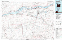
1984 Map of Hermiston
USGS Topo · Published 1984About this map
The Columbia River corridor dominates this mid-1980s landscape, illustrating a complex network of hydroelectric power, military logistics, and irrigation-based agriculture. The presence of the McNary Dam and its adjacent Powerhouse transformed the river into Lake Wallula and Umatilla Lake, creating specialized environments like the Umatilla Wildlife Refuge. Significant land is dedicated to the Umatilla Ordnance Depot, a massive facility defined by its grid of bunkers and the specialized Ordnance Airstrip.
Find a feature on this map
95 named features on this map. Tap any name to fly to it.
Don’t see what you’re looking for? This feature index may not catch every label — zoom into the map to look around manually.
Map Details
Editions of this 1984 Hermiston Map
2 editions found
Other maps of this area

1906 · Blalock Island
USGS Topo · 1:125,000

1908 · Blalock Island
USGS Topo · 1:125,000

1908 · Umatilla
USGS Topo · 1:125,000

1910 · Zillah
USGS Topo · 1:125,000

1915 · Wallulah
USGS Topo · 1:96,000

1915 · Prosser
USGS Topo · 1:125,000

1916 · Arlington
USGS Topo · 1:125,000

1916 · Condon
USGS Topo · 1:125,000

1917 · Pasco
USGS Topo · 1:125,000

1917 · Prosser
USGS Topo · 1:125,000