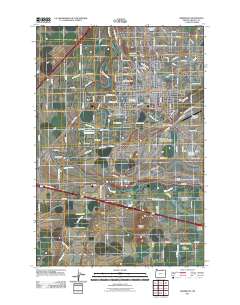
2011 Map of Hermiston
USGS Topo · Published 2011About this map
Hermiston serves as a major hub for agriculture and transportation in Umatilla County, defined by a complex network of irrigation and rail infrastructure. The landscape is etched with historical water management systems including the Maxwell Canal, Hermiston Ditch, and Westland A Canal, which supported the development of the Oregon State University Agriculture Experiment Station. The Umatilla River snakes through the southern portion of the quadrangle, passing near the industrial operations at Hinkle Yards, a significant rail facility. Small satellite settlements and named areas like Hinkle, Bucks Corners, and Umatilla Meadows reflect the dispersed rural population centers tied to the valley's water and transit routes. Prominent natural landmarks such as Hermiston Butte and Emigrant Buttes rise above the irrigated plains, providing clear geographical markers for the surrounding farms and the nearby Hermiston Municipal Airport.
Find a feature on this map
117 named features on this map. Tap any name to fly to it.
Don’t see what you’re looking for? This feature index may not catch every label — zoom into the map to look around manually.
Map Details
Editions of this 2011 Hermiston Map
This is the sole edition of this map. No revisions or reprints were ever made.
Other maps of this area

1908 · Umatilla
USGS Topo · 1:125,000

1953 · Pendleton
USGS Topo · 1:250,000

1956 · Pendleton
USGS Topo · 1:250,000

1962 · Hat Rock
USGS Topo · 1:24,000

1962 · Stanfield
USGS Topo · 1:24,000

1962 · Ordnance
USGS Topo · 1:24,000

1962 · Hermiston
USGS Topo · 1:24,000
1962 · Irrigon
USGS Topo · 1:24,000

1962 · Umatilla
USGS Topo · 1:24,000

1968 · Service Buttes NW
USGS Topo · 1:24,000