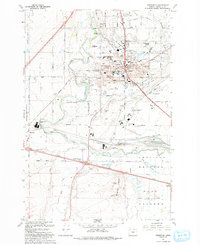
1993 Map of Hermiston
USGS Topo · Published 1993About this map
Hermiston serves as a major agricultural and transportation hub in Umatilla County, where the Umatilla River meanders past the prominent Hermiston Butte. The landscape is a complex network of irrigation, featuring the Aqueduct, various canals like the Z Canal, and numerous ditches that support the region's farms and the Hermiston Agricultural Research Center. The southern portion of the map is dominated by the massive Hinkle Yards rail facility, a vital node for the Union Pacific railroad, illustrating the area's importance in regional logistics.
Find a feature on this map
75 named features on this map. Tap any name to fly to it.
Don’t see what you’re looking for? This feature index may not catch every label — zoom into the map to look around manually.
Map Details
Editions of this 1993 Hermiston Map
This is the sole edition of this map. No revisions or reprints were ever made.
Other maps of this area

1908 · Umatilla
USGS Topo · 1:125,000

1953 · Pendleton
USGS Topo · 1:250,000

1956 · Pendleton
USGS Topo · 1:250,000

1962 · Hat Rock
USGS Topo · 1:24,000

1962 · Stanfield
USGS Topo · 1:24,000

1962 · Ordnance
USGS Topo · 1:24,000

1962 · Hermiston
USGS Topo · 1:24,000
1962 · Irrigon
USGS Topo · 1:24,000

1962 · Umatilla
USGS Topo · 1:24,000

1968 · Service Buttes NW
USGS Topo · 1:24,000