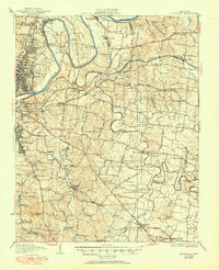
1932 Map of Hermitage
USGS Topo · Published 1950About this map
The Hermitage and the historic Soldiers Home anchor the landscape east of Nashville, reflecting the deep Jacksonian roots of Davidson County in the early 1930s. The winding course of the Cumberland River and its massive loop at Neelys Bend define the northern terrain, while the Stones River meanders through the central region toward Hermitage and Donelson. This era shows a transition from rural crossroads to early suburban nodes, with Woodbine PO and Inglewood appearing alongside vast institutional sites like the Central State Hospital and Industrial School.
Find a feature on this map
125 named features on this map. Tap any name to fly to it.
Don’t see what you’re looking for? This feature index may not catch every label — zoom into the map to look around manually.
Map Details
Editions of this 1932 Hermitage Map
3 editions found
Other maps of this area

1903 · Nashville
USGS Topo · 1:125,000

1909 · Franklin
USGS Topo · 1:62,500

1916 · Murfreesboro
USGS Topo · 1:62,500

1931 · Ridgetop
USGS Topo · 1:62,500

1932 · Hermitage
USGS Topo · 1:62,500

1932 · Nashville
USGS Topo · 1:62,500

1935 · Ridgetop
USGS Topo · 1:62,500

1942 · Gallatin
USGS Topo · 1:100,000

1942 · Lebanon
USGS Topo · 1:100,000

1949 · Franklin
USGS Topo · 1:24,000