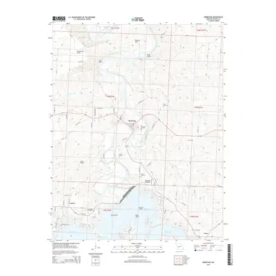
2015 Map of Hermitage
USGS Topo · Published 2015About this map
Hermitage serves as the central hub of this Missouri Ozarks landscape, where the meandering Pomme de Terre River transitions into the upper reaches of Pomme de Terre Lake. The settlement pattern follows the high ground between river bends and creek drainage, with small communities like Galmey and Carsons Corner situated along the local road network. The influence of the river on the local topography is evident in the numerous named hollows, such as Montgomery Hollow and Rough Hollow, which cut deep into the surrounding hills. Genealogists will find a significant concentration of burial sites, including Hermitage Cemetery, Dorman Cemetery, and the Dooley Bend Cemetery located near a sharp oxbow in the river. Downstream, the landscape shifts as the water backs up against Indian Point and surrounds Lost Hill Island, illustrating the local impact of twentieth-century water management on the original river valley.
Find a feature on this map
88 named features on this map. Tap any name to fly to it.
Don’t see what you’re looking for? This feature index may not catch every label — zoom into the map to look around manually.
Map Details
Editions of this 2015 Hermitage Map
This is the sole edition of this map. No revisions or reprints were ever made.
Other maps of this area

1884 · Bolivar
USGS Topo · 1:125,000

1887 · Warsaw
USGS Topo · 1:125,000

1892 · Bolivar
USGS Topo · 1:125,000

1894 · Warsaw
USGS Topo · 1:125,000

1942 · Elkton
USGS Topo · 1:24,000

1945 · Fristoe
USGS Topo · 1:62,500

1947 · Jefferson City
USGS Topo · 1:250,000

1949 · Elkton
USGS Topo · 1:24,000

1949 · Sentinel
USGS Topo · 1:24,000

1950 · Elkton
USGS Topo · 1:24,000