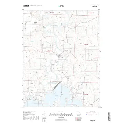
2017 Map of Hermitage
USGS Topo · Published 2017About this map
The Pomme de Terre River snakes through this landscape, feeding into the northern reaches of Pomme de Terre Lake. This survey captures the rural character of Hickory County, centered on the county seat of Hermitage. The terrain is defined by a series of distinct drainages and hollows, including Montgomery Hollow and Rough Hollow, which have shaped local movement for generations. Genealogists will find a high density of small family and community burial sites such as Clark Cem, Dorman Cem, and Liberty Cem scattered near the river's path. Settlements like Galmey and Nemo anchor the southern portion of the map, connected by a network of county roads and distinctive paths like White Lightning Trl. The transition from the river's natural meanders at Williams Bend to the broader waters of the lake at Indian Point illustrates the hybrid geography of a region adapted to both historic agriculture and modern water management.
Find a feature on this map
83 named features on this map. Tap any name to fly to it.
Don’t see what you’re looking for? This feature index may not catch every label — zoom into the map to look around manually.
Map Details
Editions of this 2017 Hermitage Map
This is the sole edition of this map. No revisions or reprints were ever made.
Other maps of this area

1884 · Bolivar
USGS Topo · 1:125,000

1887 · Warsaw
USGS Topo · 1:125,000

1892 · Bolivar
USGS Topo · 1:125,000

1894 · Warsaw
USGS Topo · 1:125,000

1942 · Elkton
USGS Topo · 1:24,000

1945 · Fristoe
USGS Topo · 1:62,500

1947 · Jefferson City
USGS Topo · 1:250,000

1949 · Elkton
USGS Topo · 1:24,000

1949 · Sentinel
USGS Topo · 1:24,000

1950 · Elkton
USGS Topo · 1:24,000