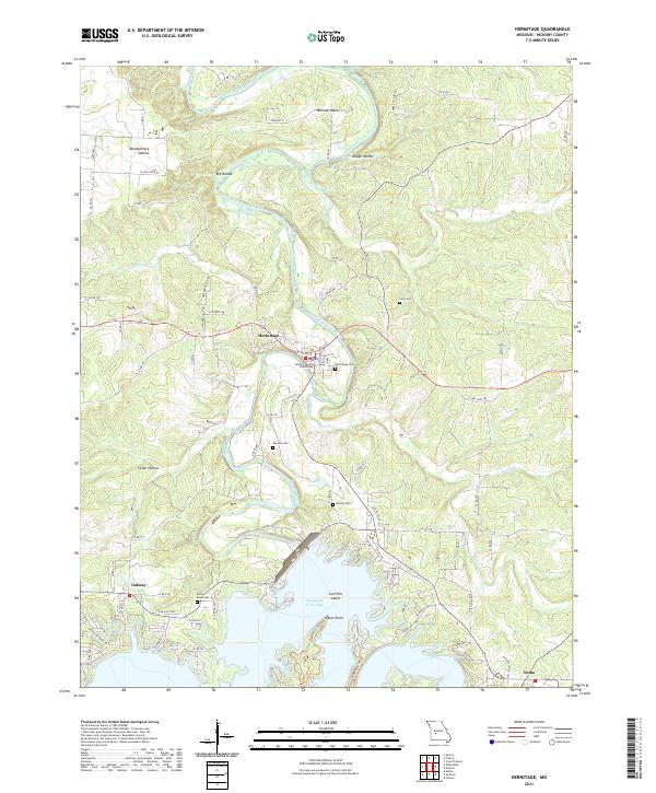
2021 Map of Hermitage
USGS Topo · Published 2021About this map
The Hickory County Courthouse in Hermitage serves as the focal point for this Hickory County survey, where the Pomme de Terre River meanders southward to feed the expansive Pomme de Terre Lake. This modern record of the landscape reveals a transition from the structured street grid of the county seat — including W Dallas St and Polk St — to the recreational and rural character of the surrounding hills. To the south, the settlements of Galmey and Nemo flank the lake's fingers, while prominent terrain features like Indian Point and Lost Hill Island define the shoreline.
Find a feature on this map
78 named features on this map. Tap any name to fly to it.
Don’t see what you’re looking for? This feature index may not catch every label — zoom into the map to look around manually.
Map Details
Editions of this 2021 Hermitage Map
This is the sole edition of this map. No revisions or reprints were ever made.
Other maps of this area

1884 · Bolivar
USGS Topo · 1:125,000

1887 · Warsaw
USGS Topo · 1:125,000

1892 · Bolivar
USGS Topo · 1:125,000

1894 · Warsaw
USGS Topo · 1:125,000

1942 · Elkton
USGS Topo · 1:24,000

1945 · Fristoe
USGS Topo · 1:62,500

1947 · Jefferson City
USGS Topo · 1:250,000

1949 · Elkton
USGS Topo · 1:24,000

1949 · Sentinel
USGS Topo · 1:24,000

1950 · Elkton
USGS Topo · 1:24,000