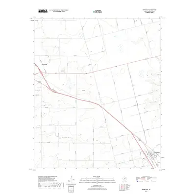
2019 Map of Hermleigh
USGS Topo · Published 2019About this map
Snyder anchors the northwestern corner of this Scurry County survey, showing the city's modern street grid including McCowen St and Laurel Ln where the road network intersects with N Bus Highway 84. The landscape transitions from these urban fringes into the ranching and agricultural plains typical of West Texas, defined by seasonal drainages and local topography. To the southeast, the small community of Hermleigh is detailed with its localized street layout, including Wheat St and Cardinal St, situated near the intersection of FM 644 and the highway.
Find a feature on this map
67 named features on this map. Tap any name to fly to it.
Don’t see what you’re looking for? This feature index may not catch every label — zoom into the map to look around manually.
Map Details
Editions of this 2019 Hermleigh Map
This is the sole edition of this map. No revisions or reprints were ever made.
Other maps of this area

1932 · Camp Springs
USGS Topo · 1:62,500

1951 · Dunn
USGS Topo · 1:24,000

1952 · Snyder
USGS Topo · 1:24,000

1952 · China Grove
USGS Topo · 1:24,000

1952 · Hermleigh
USGS Topo · 1:24,000

1954 · Lloyd Mountain
USGS Topo · 1:24,000

1954 · Brand
USGS Topo · 1:24,000

1954 · Big Spring
USGS Topo · 1:250,000

1958 · Big Spring
USGS Topo · 1:250,000

1969 · Camp Springs
USGS Topo · 1:24,000