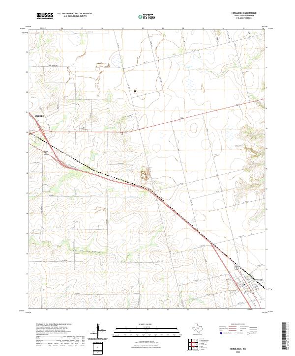
2022 Map of Hermleigh
USGS Topo · Published 2022About this map
Hermleigh and the southeastern edge of Snyder anchor this landscape in West Texas, connected by the corridor of N Bus Highway 84. The terrain is defined by dramatic drainage patterns, most notably the seasonal waterways of Camp Creek and Sulphur Creek. In the western portion of the quadrangle, the uniquely named Hell Roaring Hollow suggests a more rugged relief than the surrounding plains, providing a distinct topographical landmark for those tracing the area's physical geography. Local ranching and transportation history is visible through a network of rural routes, including Ryon Ranch Rd and Camp Springs Rd, which serve the scattered homesteads and agricultural tracts. This 2022 survey captures the contemporary layout of these small Scurry County communities, where the grid of Hermleigh sits in contrast to the more organic development near Rolling Hill and the outskirts of the county seat.
Find a feature on this map
67 named features on this map. Tap any name to fly to it.
Don’t see what you’re looking for? This feature index may not catch every label — zoom into the map to look around manually.
Map Details
Editions of this 2022 Hermleigh Map
This is the sole edition of this map. No revisions or reprints were ever made.
Other maps of this area

1932 · Camp Springs
USGS Topo · 1:62,500

1951 · Dunn
USGS Topo · 1:24,000

1952 · Snyder
USGS Topo · 1:24,000

1952 · China Grove
USGS Topo · 1:24,000

1952 · Hermleigh
USGS Topo · 1:24,000

1954 · Lloyd Mountain
USGS Topo · 1:24,000

1954 · Brand
USGS Topo · 1:24,000

1954 · Big Spring
USGS Topo · 1:250,000

1958 · Big Spring
USGS Topo · 1:250,000

1969 · Camp Springs
USGS Topo · 1:24,000