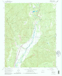
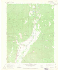
1963 Map of Hermosa
USGS Topo · Published 1981About this map
The Animas River valley serves as the central corridor for this 1963 survey, where the Denver and Rio Grande Western railroad traces the river's path through the San Juan National Forest. Small mountain settlements like Hermosa and Rockwood are positioned near the tracks, reflecting the era's reliance on the rail line for transport and access to high-altitude timber and mineral resources. The presence of the Hermosa Cem and several Prospect markings suggests a history of localized mining and community life established well before the mid-century photogrammetric update.
Find a feature on this map
50 named features on this map. Tap any name to fly to it.
Don’t see what you’re looking for? This feature index may not catch every label — zoom into the map to look around manually.
Map Details
Editions of this 1963 Hermosa Map
5 editions found
Other maps of this area

1898 · Durango
USGS Topo · 1:62,500

1898 · Engineer Mountain
USGS Topo · 1:62,500

1900 · Engineer Mountain
USGS Topo · 1:62,500

1900 · Needle Mountains
USGS Topo · 1:62,500

1902 · Needle Mountains
USGS Topo · 1:62,500

1907 · Durango
USGS Topo · 1:62,500

1908 · Engineer Mountain
USGS Topo · 1:62,500

1908 · Ignacio
USGS Topo · 1:125,000

1908 · Durango
USGS Topo · 1:62,500

1924 · Ignacio
USGS Topo · 1:125,000