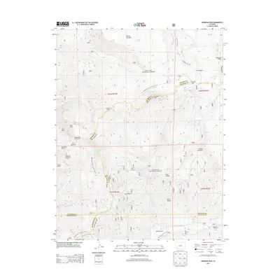
2013 Map of Hermosa Peak
USGS Topo · Published 2013About this map
Hermosa Peak and the high ridges of the Rico Mountains dominate this high-altitude landscape within the San Juan National Forest. This 2013 survey reveals a complex network of recreational and historic travel ways crossing the rugged divide, including the Blackhawk Trail / Colorado Trail 501 and the Highline Trail / Colorado Trail 520. The headwaters of the Dolores River and Hermosa Creek carve deep drainages through the terrain, with landmarks like Bolam Pass and Hotel Draw providing passage through the peaks.
Find a feature on this map
48 named features on this map. Tap any name to fly to it.
Don’t see what you’re looking for? This feature index may not catch every label — zoom into the map to look around manually.
Map Details
Editions of this 2013 Hermosa Peak Map
This is the sole edition of this map. No revisions or reprints were ever made.
Other maps of this area

1897 · Rico
USGS Topo · 1:62,500

1897 · Telluride
USGS Topo · 1:62,500

1898 · Engineer Mountain
USGS Topo · 1:62,500

1898 · Rico
USGS Topo · 1:62,500

1899 · Rico
USGS Topo · 1:62,500

1900 · Engineer Mountain
USGS Topo · 1:62,500

1904 · Telluride
USGS Topo · 1:62,500

1908 · Engineer Mountain
USGS Topo · 1:62,500

1945 · Durango
USGS Topo · 1:250,000

1953 · Mount Wilson
USGS Topo · 1:24,000