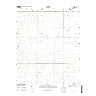
2013 Map of Hernandez Lake
USGS Topo · Published 2013About this map
Hernandez Lake and the surrounding high desert terrain define this corner of New Mexico where the De Baca Co Chaves Co line divides the landscape. This 2013 survey documents a remote ranching environment characterized by an extensive network of water management features. Named catchments like Windy Smith Tank, Grandpa Tank, and McDowell Tank are scattered across the terrain, indicating the critical importance of water storage in this arid region.
Find a feature on this map
26 named features on this map. Tap any name to fly to it.
Don’t see what you’re looking for? This feature index may not catch every label — zoom into the map to look around manually.
Map Details
Editions of this 2013 Hernandez Lake Map
This is the sole edition of this map. No revisions or reprints were ever made.
Other maps of this area

1954 · Fort Sumner
USGS Topo · 1:250,000

1955 · Roswell
USGS Topo · 1:250,000

1958 · Fort Sumner
USGS Topo · 1:250,000

1958 · Roswell
USGS Topo · 1:250,000

1962 · Roswell
USGS Topo · 1:250,000

1967 · Deering Place
USGS Topo · 1:24,000

1967 · Cottonwood Draw
USGS Topo · 1:24,000

1967 · Hernandez Lake
USGS Topo · 1:24,000
1967 · Haystack Butte
USGS Topo · 1:24,000
1967 · La Espia Peak
USGS Topo · 1:24,000