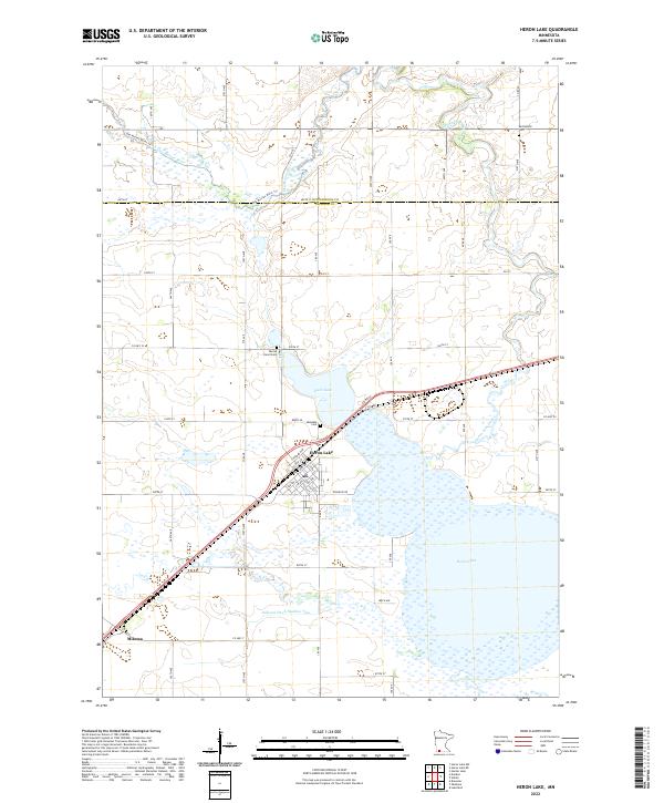
2022 Map of Heron Lake
USGS Topo · Published 2022About this map
Heron Lake dominates this Southwestern Minnesota landscape, where the namesake town of Heron Lake sits at the northern tip of an expansive wetland complex. The map reveals a highly managed hydrologic system, including Judicial Ditch Number Two, Jack Cr, and Division Creek, which drain the surrounding agricultural plains into the lake basin. Further north, the Des Moines River cuts across the prairie, accompanied by the Des Moines River Tr. Local heritage is anchored by several distinct burial grounds, including Lakeside Cem near the water's edge, Sacred Heart Cem, and Springfield Cem. To the southwest, the small settlement of Miloma marks a historic rail junction, while the grid of section lines and county roads like Co HWY 9 and Co RD 80 illustrate the persistent structure of the region's farming economy.
Find a feature on this map
57 named features on this map. Tap any name to fly to it.
Don’t see what you’re looking for? This feature index may not catch every label — zoom into the map to look around manually.
Map Details
Editions of this 2022 Heron Lake Map
This is the sole edition of this map. No revisions or reprints were ever made.
Other maps of this area

1954 · Fairmont
USGS Topo · 1:250,000

1958 · Fairmont
USGS Topo · 1:250,000

1960 · Brewster
USGS Topo · 1:24,000

1960 · Okabena
USGS Topo · 1:24,000

1970 · Heron Lake NW
USGS Topo · 1:24,000
1970 · Harder Lake
USGS Topo · 1:24,000

1970 · Dundee
USGS Topo · 1:24,000

1970 · Wilder
USGS Topo · 1:24,000

1970 · Lakefield
USGS Topo · 1:24,000
1970 · Heron Lake NE
USGS Topo · 1:24,000