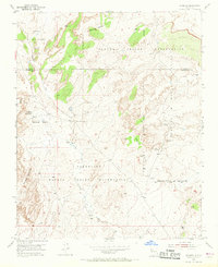
1954 Map of Herrera
USGS Topo · Published 1968About this map
Laguna Indian Reservation and Canoncito Navajo Indian Reservation lands dominate this mid-century New Mexico landscape, revealing a complex intersection of tribal territories and historical land grants. In the northwest, the small settlement of Herrera is anchored by the Capilla de San Ignacio and an adjacent Cem, reflecting a localized communal center in the high desert. The terrain is marked by distinctive formations like La Mesita Blanca and the drainage of Canada de los Alamos.
Find a feature on this map
22 named features on this map. Tap any name to fly to it.
Don’t see what you’re looking for? This feature index may not catch every label — zoom into the map to look around manually.
Map Details
Editions of this 1954 Herrera Map
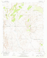
Other maps of this area

1883 · Mt. Taylor
USGS Topo · 1:250,000

1886 · Mt. Taylor
USGS Topo · 1:250,000

1888 · Bernalillo
USGS Topo · 1:125,000

1889 · Albuquerque
USGS Topo · 1:125,000

1892 · Mt. Taylor
USGS Topo · 1:250,000

1893 · Albuquerque
USGS Topo · 1:125,000

1899 · Mt. Taylor
USGS Topo · 1:250,000

1954 · Herrera
USGS Topo · 1:24,000

1954 · Sky Village
USGS Topo · 1:24,000

1954 · Canoncito School
USGS Topo · 1:24,000