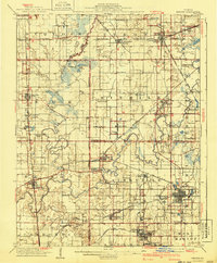
1910 Map of Herrin
USGS Topo · Published 1940About this map
Southern Illinois coal country and the agricultural lands surrounding the Big Muddy River are the focus of this detailed survey. Centered on the industrial growth of Herrin and Christopher, the map captures the transition from rural farming communities to rail-dependent mining towns. Extensive rail networks like the Coal Belt RR and the Illinois Central link these settlements, while smaller communities such as Dewmaine, Energy, and Colp appear alongside numerous rural education centers like Arkansas School and Denning School.
Find a feature on this map
84 named features on this map. Tap any name to fly to it.
Don’t see what you’re looking for? This feature index may not catch every label — zoom into the map to look around manually.
Map Details
Editions of this 1910 Herrin Map
2 editions found
Other maps of this area

1909 · West Frankfort
USGS Topo · 1:62,500

1910 · Herrin
USGS Topo · 1:62,500

1910 · Murphysboro
USGS Topo · 1:62,500

1922 · Carbondale
USGS Topo · 1:62,500

1924 · Alto Pass
USGS Topo · 1:62,500

1924 · Pinckneyville
USGS Topo · 1:62,500

1925 · Marion
USGS Topo · 1:62,500

1926 · Pinckneyville
USGS Topo · 1:62,500

1926 · Duquoin
USGS Topo · 1:62,500

1936 · Herrin
USGS Topo · 1:62,500