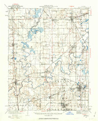
1936 Map of Herrin
USGS Topo · Published 1963About this map
The Big Muddy River and its numerous tributaries, including the Little Muddy River and Crab Orchard Creek, dominate this portion of Southern Illinois during the mid-1930s. This survey, revised by R.B. Marshall and his team, reveals a landscape densely populated with small coal-era settlements and a complex network of railroads like the Illinois Central and the Coal Belt. The distribution of rural schools, such as Highbank School and Arkansas School, alongside churches like Williams Church, reflects the established farming and mining communities of the time.
Find a feature on this map
89 named features on this map. Tap any name to fly to it.
Don’t see what you’re looking for? This feature index may not catch every label — zoom into the map to look around manually.
Map Details
Editions of this 1936 Herrin Map
2 editions found
Other maps of this area

1909 · West Frankfort
USGS Topo · 1:62,500

1910 · Herrin
USGS Topo · 1:62,500

1910 · Murphysboro
USGS Topo · 1:62,500

1922 · Carbondale
USGS Topo · 1:62,500

1924 · Alto Pass
USGS Topo · 1:62,500

1924 · Pinckneyville
USGS Topo · 1:62,500

1925 · Marion
USGS Topo · 1:62,500

1926 · Pinckneyville
USGS Topo · 1:62,500

1926 · Duquoin
USGS Topo · 1:62,500

1936 · Herrin
USGS Topo · 1:62,500