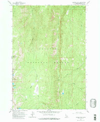
1963 Map of Hershey Point
USGS Topo · Published 1979About this map
Sams Throne and Hershey Point dominate the high-altitude topography of this 1963 field-checked survey within the Payette National Forest. The landscape is defined by the steep drainage basins of French Creek and Elkhorn Creek, illustrating a classic central Idaho mountain profile before extensive modern development. Human presence in this isolated portion of Idaho County is minimal, marked primarily by a remote Cabin and the Landing Strip at Elk Meadows, which hints at the era’s reliance on aerial access for forest management and backcountry travel. Along the western edge, Lava Butte Ridge rises above Lava Butte Lakes, while Jenkins Crossing provides a named point of reference for those navigating the rugged creek-side terrain by trail or jeep.
Find a feature on this map
24 named features on this map. Tap any name to fly to it.
Don’t see what you’re looking for? This feature index may not catch every label — zoom into the map to look around manually.
Map Details
Editions of this 1963 Hershey Point Map
2 editions found
Other maps of this area

1938 · Riggins
USGS Topo · 1:96,000

1945 · Riggins
USGS Topo · 1:125,000

1955 · Grangeville
USGS Topo · 1:250,000

1956 · Burgdorf
USGS Topo · 1:62,500

1956 · Elk City
USGS Topo · 1:250,000

1959 · Grangeville
USGS Topo · 1:250,000

1960 · Elk City
USGS Topo · 1:250,000

1963 · Black Tip
USGS Topo · 1:24,000

1963 · Hershey Point
USGS Topo · 1:24,000
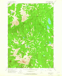
1963 · Hazard Lake
USGS Topo · 1:24,000