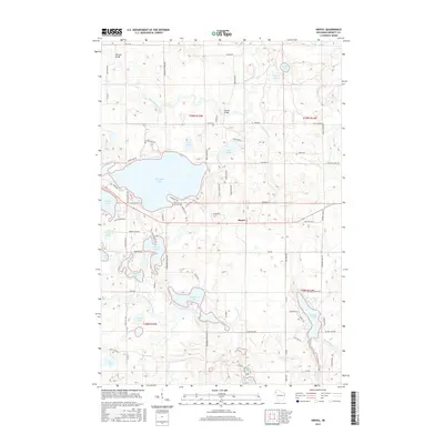
2015 Map of Hertel
USGS Topo · Published 2015About this map
Hertel serves as a central point in this lake-strewn landscape of Burnett County, where the intricate network of water bodies and glacial geography defines the region's character. The massive footprint of Big Sand Lake dominates the central portion of the map, neighbored by the Big Sand Lake Cem and the distinctive peninsula of Gatten Point extending into Warner Lake. This survey illustrates a complex hydrological system where the Yellow River and North Fork Clam River navigate through numerous smaller basins like Pokegama Lake and Bashaw Lake. The presence of Whistler Bridge and Pearson Bridge crossing the Yellow River indicates the vital transport connections maintained for local access. The dense distribution of lakes, including Viola Lake, Lost Lake, and Temple Lake, reflects the classic Northwoods glacial topography that has long supported local recreation and residential patterns.
Find a feature on this map
82 named features on this map. Tap any name to fly to it.
Don’t see what you’re looking for? This feature index may not catch every label — zoom into the map to look around manually.
Map Details
Editions of this 2015 Hertel Map
This is the sole edition of this map. No revisions or reprints were ever made.
Other maps of this area

1949 · Hertel
USGS Topo · 1:48,000

1950 · Webster
USGS Topo · 1:48,000

1951 · Cumberland
USGS Topo · 1:48,000

1951 · Frederic
USGS Topo · 1:48,000

1953 · Stillwater
USGS Topo · 1:250,000

1955 · Hertel
USGS Topo · 1:62,500

1955 · Webster
USGS Topo · 1:62,500

1955 · Frederic
USGS Topo · 1:62,500

1955 · Stillwater
USGS Topo · 1:250,000

1956 · Cumberland
USGS Topo · 1:62,500