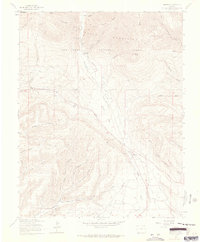
1963 Map of Hesperus
USGS Topo · Published 1965About this map
The La Plata River cuts through this high-altitude landscape in the mid-1960s, serving as a corridor for settlement and industry between the San Juan Mountains and the lower plateaus. The town of Hesperus sits as a central hub, flanked by the Hesperus Cem and the Hesperus Ski Center. Further north, the settlement of Mayday marks the entrance to a canyon rich with mining history, including the Snowslide Mine and Bay City Mine. Evidence of past infrastructure is visible in the Old Railroad Grade winding through the western hills near Cherry Creek. The map documents a rugged economy transitioning from resource extraction to recreation, with numerous named coal and precious metal mines like the Coal King Mine and Pioneer Mine scattered near irrigation works such as the Big Stick Ditch and La Plata Ditch.
Find a feature on this map
55 named features on this map. Tap any name to fly to it.
Don’t see what you’re looking for? This feature index may not catch every label — zoom into the map to look around manually.
Map Details
Editions of this 1963 Hesperus Map
4 editions found

Other maps of this area

1895 · La Plata
USGS Topo · 1:62,500

1897 · La Plata
USGS Topo · 1:62,500

1898 · Durango
USGS Topo · 1:62,500

1899 · La Plata
USGS Topo · 1:62,500

1907 · Durango
USGS Topo · 1:62,500

1908 · Ignacio
USGS Topo · 1:125,000

1908 · Durango
USGS Topo · 1:62,500

1908 · La Plata
USGS Topo · 1:62,500

1913 · Red Mesa
USGS Topo · 1:62,500

1924 · Ignacio
USGS Topo · 1:125,000