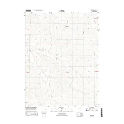
2015 Map of Hessdale
USGS Topo · Published 2015About this map
Hessdale sits at a crossroads in the Flint Hills region, where local routes like Hessdale Rd and Halifax Rd converge. This rural landscape is defined by its drainages, including the East Br Mill Cr and Nehring Cr, which have shaped the placement of early family settlements and burial grounds. Genealogists will find significant value in the distribution of several community landmarks, specifically the Swedish Cem, Troemper Cem, and Nehring Cem, reflecting the diverse immigrant and pioneer heritage of Wabaunsee County. The terrain is marked by a network of ridge-running roads such as Skyline Rd and Divide Rd, offering a view of how the agricultural economy and transport patterns were established around the winding paths of Kuenzli Cr and Snokomo Cr.
Find a feature on this map
30 named features on this map. Tap any name to fly to it.
Don’t see what you’re looking for? This feature index may not catch every label — zoom into the map to look around manually.
Map Details
Editions of this 2015 Hessdale Map
This is the sole edition of this map. No revisions or reprints were ever made.
Other maps of this area

1885 · Eskridge
USGS Topo · 1:125,000

1889 · Wamego
USGS Topo · 1:125,000

1889 · Eskridge
USGS Topo · 1:125,000

1894 · Eskridge
USGS Topo · 1:125,000

1894 · Wamego
USGS Topo · 1:125,000

1953 · Maple Hill
USGS Topo · 1:24,000

1954 · Alma
USGS Topo · 1:24,000

1954 · Mc Farland
USGS Topo · 1:24,000

1955 · Manhattan
USGS Topo · 1:250,000

1955 · Hutchinson
USGS Topo · 1:250,000